// Solutions — SOL-005

FCC License Survey

A geospatial FCC spectrum license survey tool that maps every licensed emitter within a search area by location, frequency, and band. An interactive map and a sortable, exportable license table give operators fast ground-truth on the licensed RF environment around any point of interest.

Operational tool · sample output below
392k+
Licensed Emitters Indexed
HF–W
IEEE Bands, Color-Coded
51
FCC Service Types
REST
API for Integration
// Tool Output
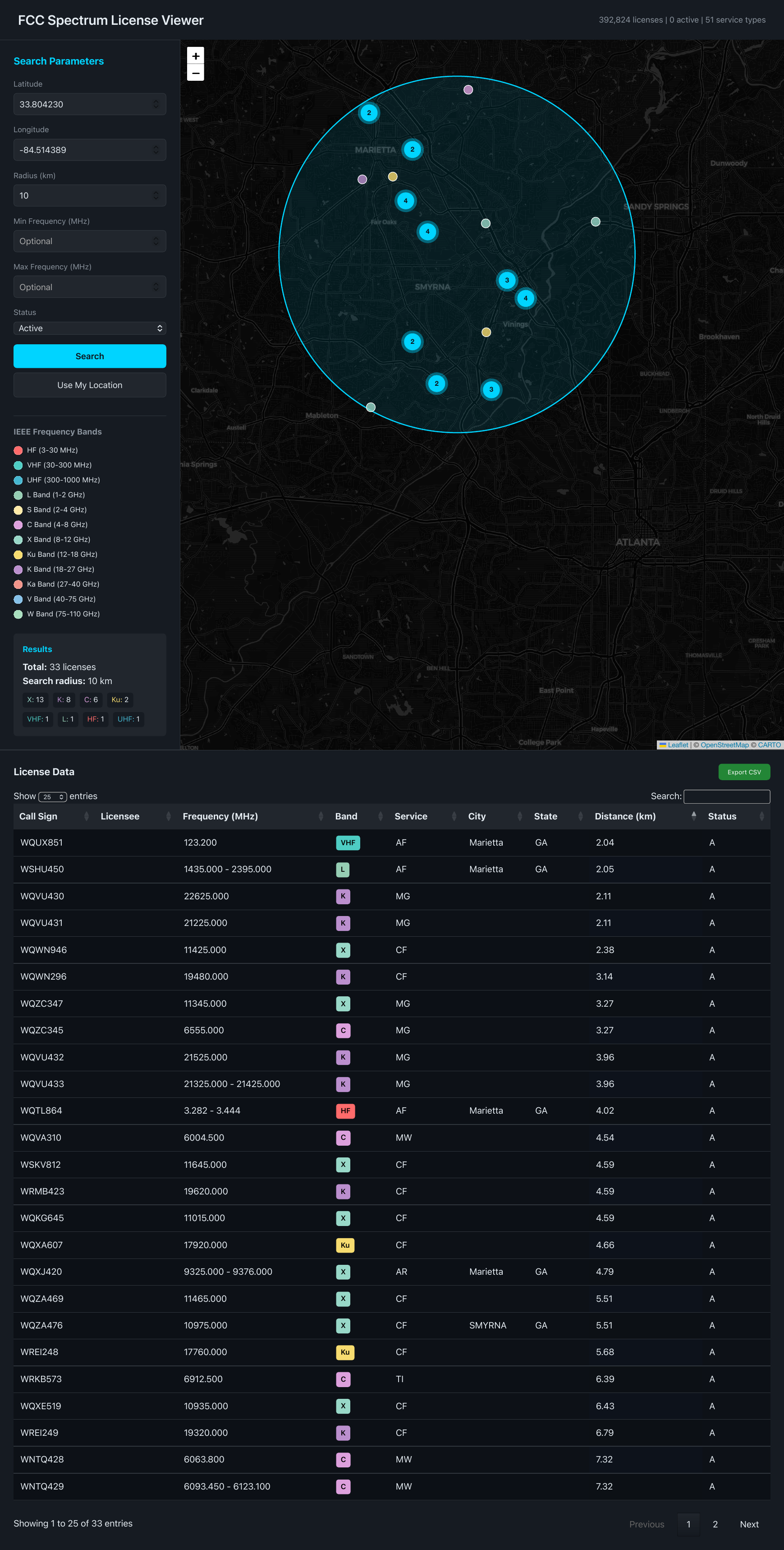
FCC Spectrum License Viewer — map with IEEE band-coded markers and license data table
FCC Spectrum License Viewer — radius search with IEEE band-coded markers View full screenshots (PDF) ↗
◎ GEO
Spatial Search

Center-point + radius or bounding-box searches return every licensed emitter in the area of interest, in seconds.

▤ BAND
Band Color-Coding

Markers colored by IEEE frequency band — HF through W band — for instant spectral read of an area.

▦ DATA
License Table & Export

Sortable, filterable table of call sign, frequency, service, location, and status with CSV export.

⌁ API
REST API

Programmatic access built for integration — fold survey results directly into your own tools and workflows.

Need a Spectrum Survey?

We run FCC license surveys against any area of interest and fold the results into broader RF environment and spectrum-management work. Contact us to request a survey or a live demo.

Request Survey →
← Back to Solutions